Description
Laser Tech’s Joint Pole is a field data collection app that Electric Utility professionals and their contractors use to measure the location, condition, attachment height, and make-ready measurements on utility poles. Utilizing the TruPulse laser’s non-contact technology, the operator can stand in a safe and convenient location to collect the data.
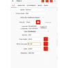
The user fills out a series of tabs of information about the pole, its location and dimensions, the present condition and any issues that need to be addressed. All the equipment attached to the pole can identified using customizable lists. Build the pull-down lists using the type of equipment and owners particular to your job. When it’s time to measure with the laser, graphic prompts will trigger measurements from the TruPulse to record all the necessary height, span, sag and clearance values.
At the end of the day, the user opens the Report screen and selects from PDF, CSV, and TXT formats. GPX and KML files are also available when GPS has been used to locate the poles. With a network connection, these files are transmitted via email directly from the device. They can also be moved over at the office via cable connection to a PC. Laser Tech’s Joint Pole application is an efficient way to streamline the field data collection process for make-ready engineering work, pole loading analysis, and other aerial inspections.
Try the Joint Pole app today with a full-featured 30-day free trial period. Licensing is a one-time purchase with no recurring fees.
Android™ is a trademark of Google LLC


